20 students from 12 countries have been exploring different ways to monitor the cryosphere in the Semi-Arid Andes of Chile. This is an area where up to 80% of the streamflow is derived from the cryosphere, and has also seen the amount of water available through the river decline in recent years due to climate change. Given the high-altitude of the ice masses, conventional glacier monitoring techniques, such as ablation stakes are not possible. As such, the group has been learning how satellite and aerial imagery can be used to quantify cryospheric change. Prior to fieldwork, Benjamin Robson (UiB, Earth Science) taught how to use stereo satellite imagery to produce high-resolution 3D models of the glaciers and rock glaciers in the catchment and quantify how their surface has changed over time, Gidske Andersen (UiB, Geography) demonstrated how to extract decadal trends in snowcover using satellite data available in Google Earth Engine, a cloud-based portal where all the analysis is performed on Google’s servers. Lastly, Diego Cusicanqui (Université Grenoble Alpes) lead a session on how to perform feature tracking between successive images in order to calculate how fast glaciers and rock glaciers were flowing.
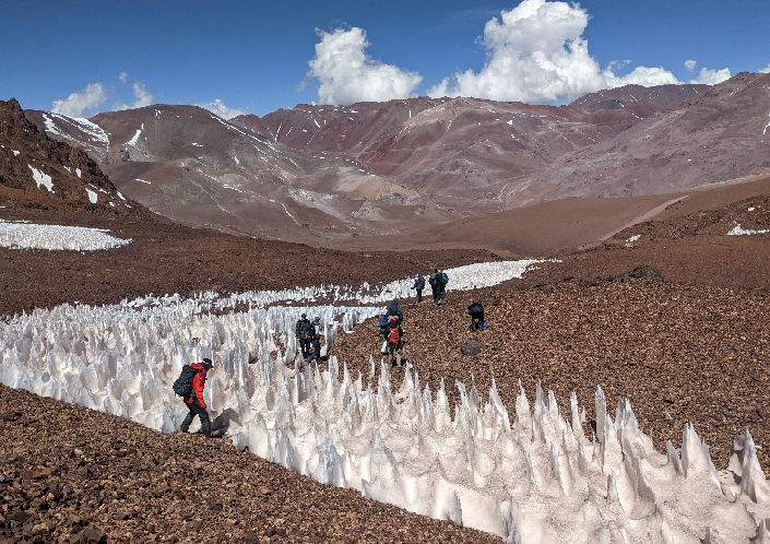
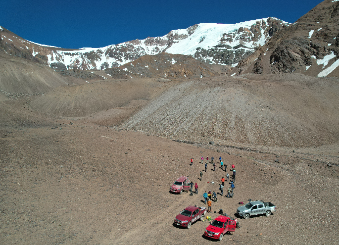
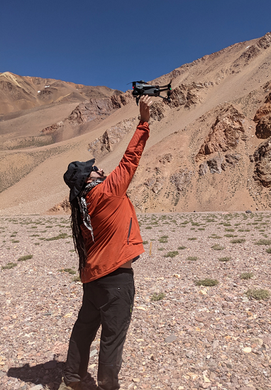 The group then spent 4 days in the La Laguna catchment, between 3000 and 4700 m a.s.l. and were joined by Pål Ringkjøb Nielsen and Jostien Bakke (UiB, Earth Science). Shelley MacDonell (CEAZA, Chile, and Lincoln University, New Zealand) lead the group through the Elqui valley, stopping off to discuss with the local water authorities that are tasked with distributing water among the catchment. Once up in the mountains, the students planned and executed a series of high-resolution Unmanned Aerial Vehicle (UAV) missions over various glaciers and rock glaciers, as well as performing geomorphological mapping and surveying how fast the rock glaciers were moving with a differential DGPS.
Back in La Serena, the students are now working with processing the UAV data and comparing it with satellite products to quantify rates of glacial change, and will present their findings to researchers at CEAZA tomorrow.
Text and photos: Benjamin Robson